First decent ride in a while, to Belgrave and Ringwood
Sunday, January 20th, 2008 at 03:11pm
Yesterday Damien and I went on our first ride since last May, what was planned as a nice big loop that included Belgrave and Croydon.
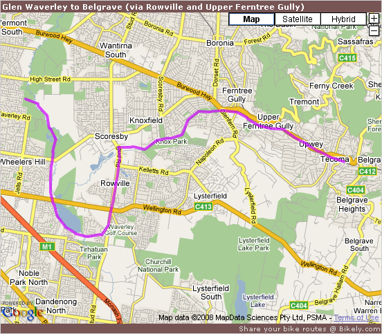
First we went via Scoresby and Upper Ferntree Gully to Belgrave:
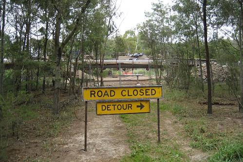
The new bridge for the Eastlink Trail is well underway at the south end of Jells Park:
And, despite the website saying otherwise, the upgraded trail south of Ferntree Gully Road is open:
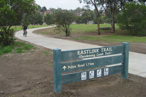
all the way to where Eastlink crosses the Dandenong Creek in Mulgrave:

But some landscaping and cleanup is still to be done.
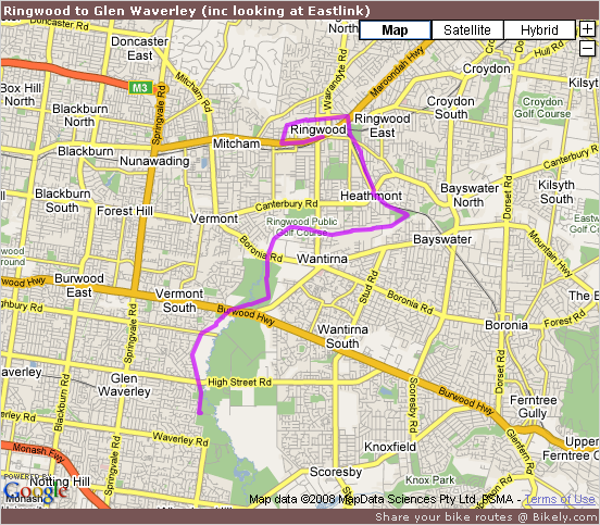
Since it drizzled for much of the ride to Belgrave we decided to catch the train to Ringwood and continue riding from there:
Paths near the Ringwood Bypass are done, but not yet open:

And the upgraded path through Koomba Park has been open for six months now:

Apart from the drizzle it was an enjoyable ride and once Eastlink is complete there will be a decent network with many combinations to enjoy.
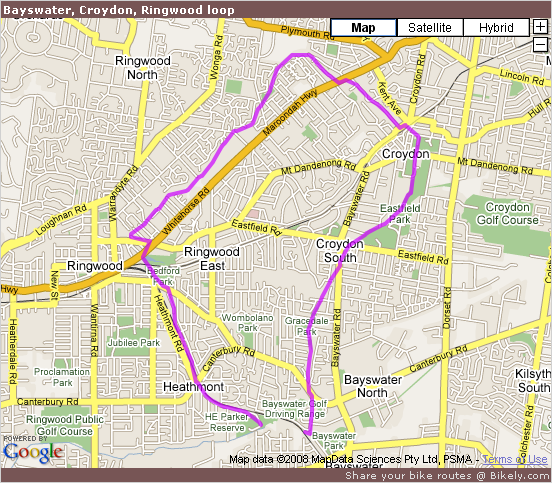
Part of what we skipped was a loop from Bayswater to Croydon (via the Tarralla Creek Trail), Ringwood (via the Upper Mullum Mullum Creek Trail) and back to Bayswater:
Some more photos are available in my Bike paths and Eastlink (January 2008) Flickr set.
Tagged with: cycling, eastlink, flickr, photos

“Some more photos are available in my Bike paths and Eastlink (January 2007) Flickr set.”
Should be 2008 – just to be picky. :)
Thanks for the photos.
ozzmosis - January 21st, 2008 at 10:52 pm
BTW, Google Picasaweb might be worth checking out. You can use Google Maps to pin a location to a photo, eg. http://picasaweb.google.com/ozzmosis/WesternPortBayTrail/photo#5154305389356646050 . Scroll down and on the right you can see a pin on the map where the photo was taken. I don’t think Flickr offers that capability?
I’m looking forward to riding the Eastlink trail myself when it opens completely, starting from Seaford. It looks as though I might be able to ride all the way to Diamond Creek, if I don’t get lost first. :)
ozzmosis - January 21st, 2008 at 11:23 pm
Um, yes… the flickr set now has the correct year.
Stephen - January 21st, 2008 at 11:28 pm
Flickr does have map capabilities and your comment reminded me to do it. See just that set on the map.
However, it uses the Yahoo! maps so there are no street maps for Melbourne and the images are quite old. But that is good in a sense as it lets you see what was there before they started to build EastLink.
I currently use Picasa to sort through my photos, but I have had my Flickr account for longer than that. For these photos I sorted and edited (just cropping for these) in Picasa, exported them and then uploaded the exported photos to Flickr.
However I suppose that Picasa Web would make it easier to keep my copies and the online versions in sync (titles, descriptions, etc).
Stephen - January 21st, 2008 at 11:51 pm
As for Seaford to Diamond Creek, you won’t get all the way on the bike path. EastLink is only reducing the gap between the upper and lower parts of the Mullum Mullum Creek Trail, not eliminating it. Once you get to Park Road or Mitcham Road you will need to use the road to get to the lower part of the trail at Old Warrandyte Road.
Unless you went along the Eastern Freeway to Heidelberg and then up the Yarra Trail…
Stephen - January 22nd, 2008 at 12:07 am