GPS tracks and tall buildings
Saturday, July 30th, 2022 at 09:21pm
Today I was in the city for the first day of Open House Melbourne and I have just finished geotagging the photos. My approach of shooting both JPG and CR3 so I could use the JPG for geotagging worked out ok.
I did use gpsPhoto.pl to tag them all and while I expected the photos taken indoors to either not have a found location or to be in the wrong location, I had forgotten how bad a GPS track around a lot of tall buildings could be:
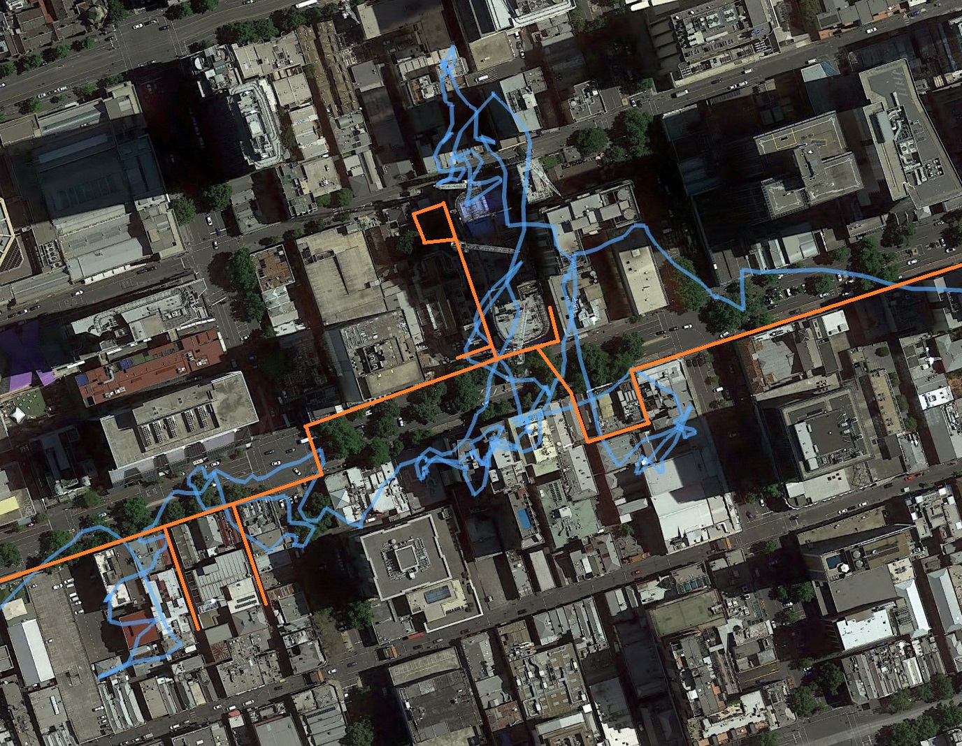
This is a screenshot of Google Earth showing in blue the result of the GPS track, while the orange lines are indicating the path I actually took.
When I manually correct the locations on the images I am not trying to be too precise, within 5 metres maybe 10. Close enough that if you go to that location you should be able to look around and see the thing or perspective I was taking a photo of. An error of a few hundred metres might not matter much for a landscape out in the country, but in a dense urban environment I want to be close.
Tagged with: geotagging, photos
