Water and gold
Saturday, March 19th, 2011 at 10:20pm
All the way from Adelaide to Perth we followed the coast, so much so that I was getting a bit tired of beaches, coves and bays. However now, our second day out from Perth, the coastline is only a memory as we are well and truly inland where the two most important things are water and gold. Water so you can survive, and gold to give a reason to be here. On the way we also passed through the wheatbelt, but the area from Southern Cross through to Kalgoorlie is about gold.
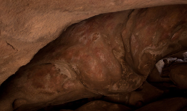
After checking out of the motel in Hyden our first stop was The Humps, another rock formation a few kilometres north of Wave Rock. We declined the walk up the rock, instead just visiting Mulcas Cave, a cave formed from a hollow boulder that is filled with aboriginal art.
Continuing north on the back roads leads directly to Southern Cross on the Great Eastern Highway. Though minor roads, this route is fairly well travelled as the other route (the only way that Google and others know) is about 300 kilometres longer. The direct route took us past the town of Marvel Loch and its large pit mine before we stopped for lunch at a roadhouse in Southern Cross. We had hoped to find something better for lunch, but it is Saturday and nothing appeared to be open.
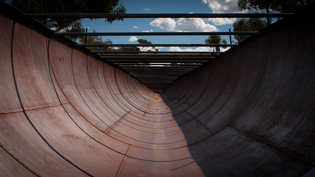
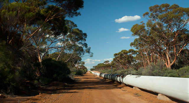
Starting near Perth at Mundaring Weir and running all of the way to Kalgoorlie is a water pipeline, as you drive you see it running along the highway, sometimes dropping below ground, or at other times jumping to the other side of the road. The Golden Pipeline Heritige Trail follows the pipeline as well as highlighting places of historic interest along the pipeline. It was due to this trail that we stopped at the old pumping station no. 6 and also detoured to an old dam at Karalee Rock.
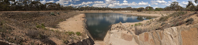
This is a dam that was used before the pipeline to supply first people travelling along the road and then supply trains along the railway line. A wall was placed around a large granite rock to capture water and feed it to the dam along an iron aqueduct.
The heritage trail also led us along the pipeline instead of the highways for a longer than expected section, this also included a short section along what we believe is the old railway alignment.
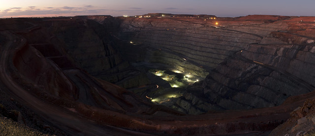
Eventually we arrived in Coolgardie where we had a brief look around before continuing on to Kalgoorlie. Our first stop (after checking into the motel) was the Mount Charlotte Reservoir and Lookout, it was only later that we learned that the large number of photographers were photographing the moon was because it was a supermoon. Our second stop was at the Super Pit lookout where we managed to get some shots in the fading light.
Tagged with: road trip
