Blog entries from March, 2013

Last day of driving

Sunday, March 31st, 2013 at 10:07pm

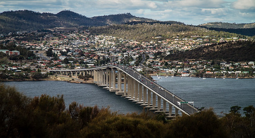
Earlier this evening the driving portion of this road trip was completed when we arrived back in Devonport. Of course this was with just enough time to check into the motel, find some dinner and then get back to watch the new episode of Doctor Who.

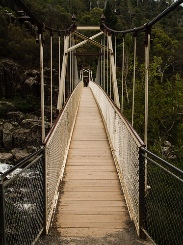
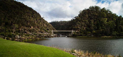
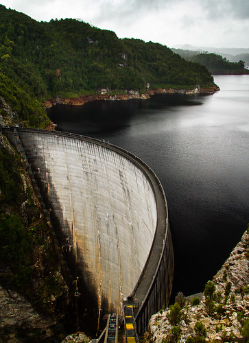
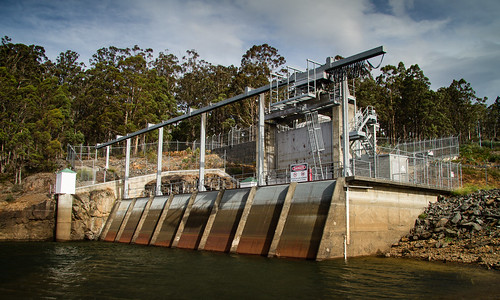
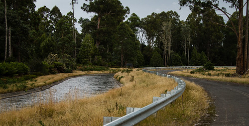
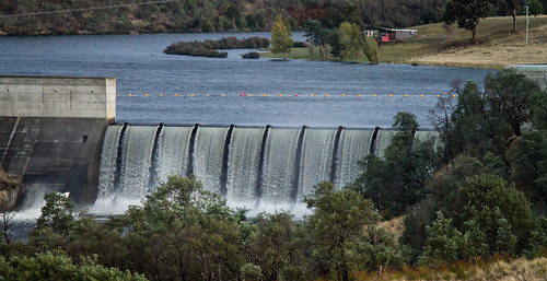
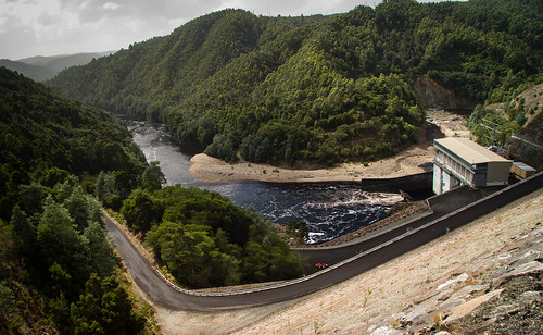
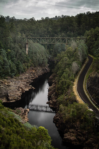
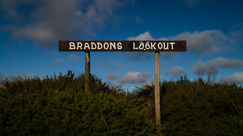
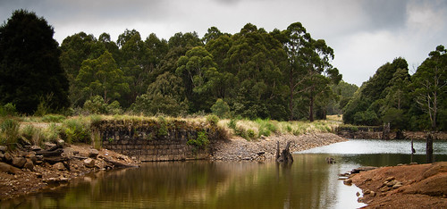
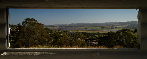
The day started in Launceston with a brief stop by the Trevallyn Dam and a lookout on the western side of town.

Looking down the Tamar

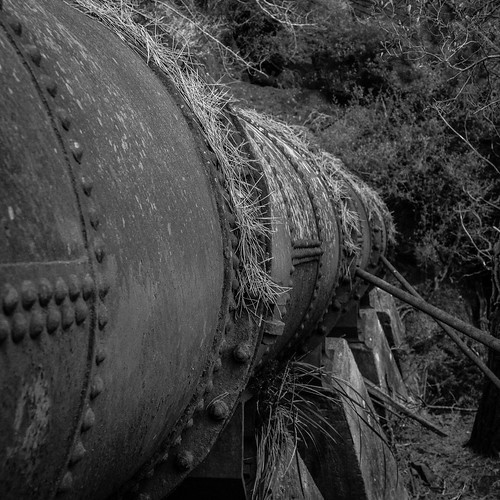
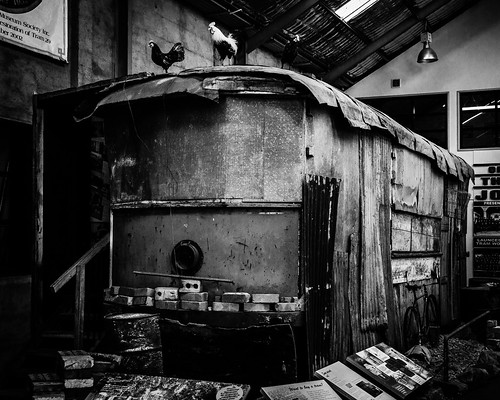
We then visited the Launceston Tramway Museum where it was quite interesting to see that although they only ever had 29 trams, they have managed to track down all of them. Of course not all have survived, some are being restored and this example has been retained as an example of the chook shed it had been converted into.

There's a tram in there

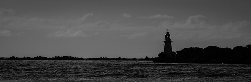
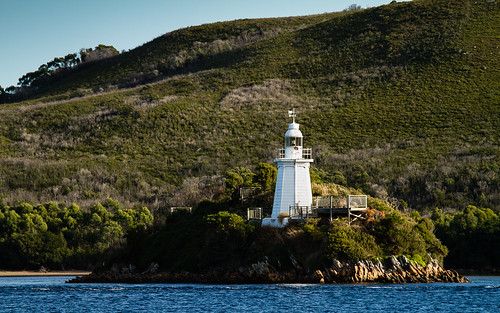
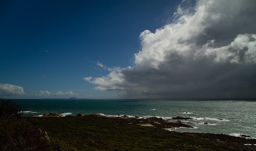
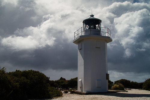
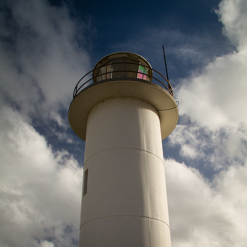
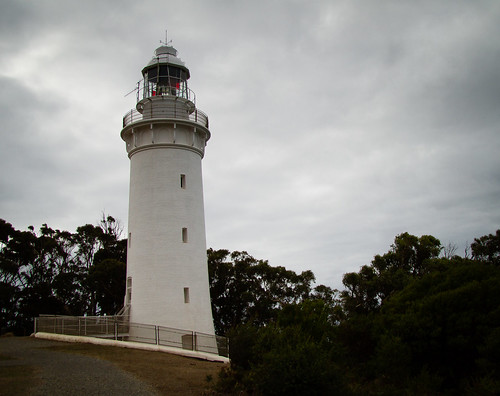
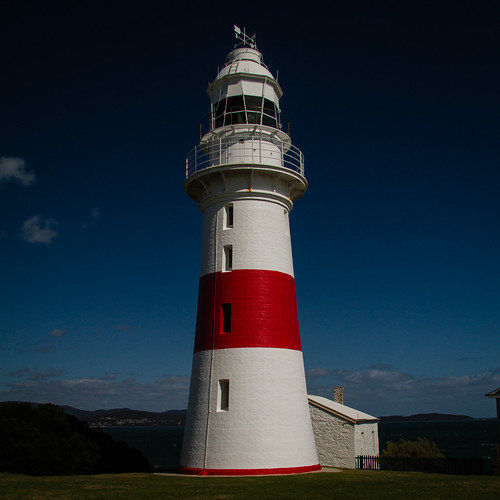
From Launceston we followed the eastern side of the Tamar River to George Town where we were lucky enough to arrive at lighthouse at noon, just at the time that they sounded the restored fog horn.

Horizontal stripe

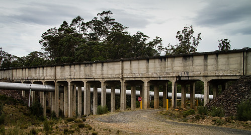
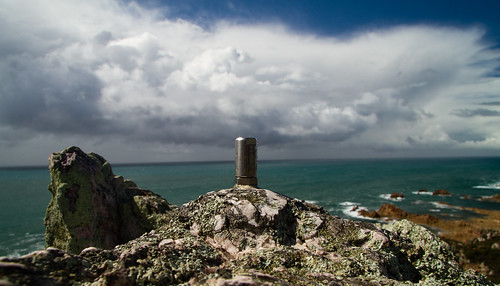
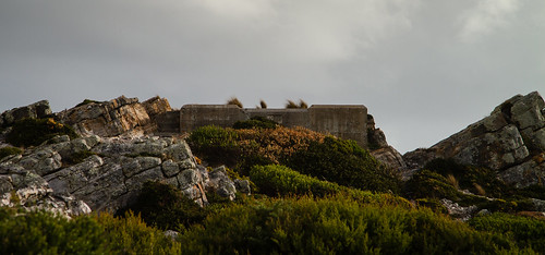
Heading back up the river we stopped at one of the old semaphore stations (that linked George Town with Launceston).

Chain

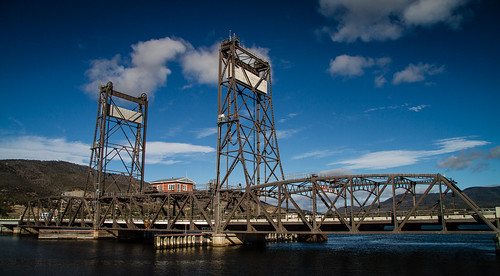
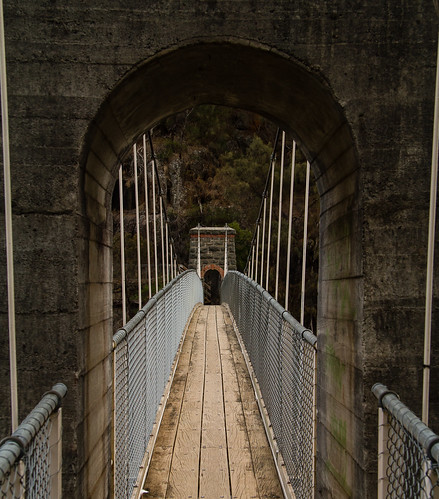
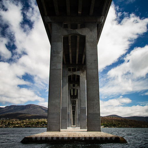
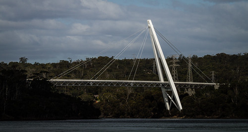
Crossing over the Tamar was via the Batman Bridge – the first cable-stayed bridge in Australia.

Another Australian first

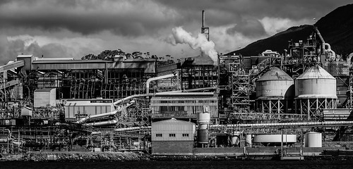
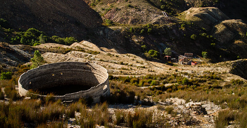
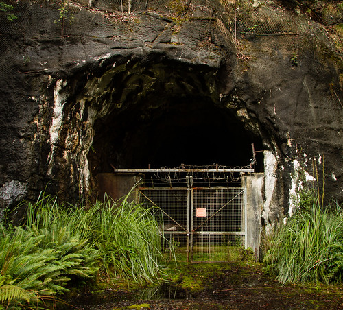
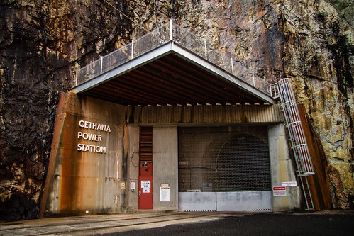
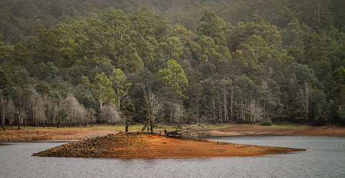
Now on the western side of the river we visited the mining museum at Beaconsfield, didn’t see much at Greens Beach, skipped visiting Port Sorell and then arrived in Devonport.

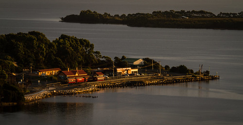
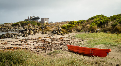
Although we did see the Spirit come into port at Devonport, our booking is for tomorrow (a day sailing) as we wanted to keep our last driving day flexible. We did ask if we could change our booking to tonights sailing, but it would have cost $300 to change it at this late stage…

Tagged with: , ,

Up through the middle

Saturday, March 30th, 2013 at 09:45pm

As this road trip through western Tasmania draws to a close, today we travelleled north from Hobart to Launceston, but we didn’t just follow the main highway.

From Hobart we headed back up the Derwent River to have another look at its vertical lift bridge.

Largest of its kind

From there we continued north, but then turned off into the hills to the Waddamana Power Station Museum.

Grand entrance

The museum was an excellent source for photos of old machinery and switching gear. This alone has provided many photos for me to sort through later.

From Waddamana we headed up to the Miena Dam on Great Lake. The water level was low enough to expose the second Miena Dam (a series of concrete arches) behind the current rockfill dam. It wasn’t quite low enough to expose the first concrete dam, but it was just visible.

First (just), second and third

Around the corner from the Miena Dam was the outlet of the pipe where water is pumped up from Arthurs Lake. Here is a small power station that uses that water to reclaim some of the energy.

Cost recovery

Continuing north we dropped down the Great Western Tiers and then arrived in Launceston in mid-afternoon. This gave us time to visit Cataract Gorge, both First Basin and the old Duck Reach power station.

Suspended

First basin

Gathering needles

New(er) concrete, older stone

We also drove around Launceston, noting the Tramway Museum for a visit tomorrow.

Tagged with: , ,

Hobart on Good Friday…

Friday, March 29th, 2013 at 10:15pm

Our Tasmania road trip is almost over with today being a full day in Hobart. Today is also Good Friday. What is Hobart like on Good Friday? In our roaming around searching for things to do or see we did stop by the Waterfront and Salamanca Place. The former featuring a cruise ship in port and the latter the busiest place we saw all day.

After an early lunch we headed over the Tasman Bridge to the Rosny Hill Lookout, drove past the Bellerive Oval before stopping under the eastern approach to said bridge.

Under the Tasman

We then headed up the eastern side of the Derwent River, stopping at a few places which included shortly before the Bowen Bridge with a view across the river of the zinc smelter. (and the Incat shipyard, but nothing interesting was visible)

Mechanical

After crossing the river we headed over the the Tasmanian Transport Museum which we understood to be “open on Saturdays, Sundays and Public Holidays”. It seems that Good Friday isn’t a public holiday, as it was not open. With more time to kill, but not in the mood to look at actual art we found a place to photograph Mona from a distance.

The villain's lair

Heading back south (we were working our way anti-clockwise) we stopped at the western approach to the Tasman bridge before heading up into Queens Domain. As we now expect, the view from the summit lookout was obscured by trees, but interestingly there was access onto a pair of huge water tanks, from which there was a clear view of the Tasman Bridge.

Connection to the east

By now we had exhausted our short list of places to go, but it was only mid afternoon. To fill the time we brought forward our visit to Richmond from tomorrow. On the way we spotted some dishes not far from the road, which turned out to be the Mount Pleasant Radio Observatory.

An unexpected find

Later research informed us that one of the dishes (not the one pictured) is from the former Orroral Valley Tracking Station which we stopped at on a previous road trip.

Continuing on to Richmond we of photographed the bridge…

One hundred and ninety

… before heading back to Hobart via Sorrell, Seven Mile Beach and even Rokeby where we spotted this sign.

Something for sale

Since we stopped via Richmond today, tomorrows plan is now to head straight for the Hydro Museum at Waddamana before ultimately ending up in Launceston.

Tagged with: , ,

A day of driving

Thursday, March 28th, 2013 at 11:06pm

Today’s leg started out with a visit to Russell Falls, but there wasn’t much water flowing over them.

Russell Falls

We then headed west to visit the Gordon Dam, a drive of approximately 200 kilometres return with not much to see on the way. It was also raining for most of the drive, we where lucky to get a couple of breaks while at the dam itself. We also stopped by the Serpentine Dam, but that is in no way as interesting to photograph.

Tallest in Tasmania

Once we returned to the main highway, we followed the Derwent River all of the way into Hobart. In an attempt to catch the sunset we headed up Mount Wellington which was clouded in when we initially arrived, but we were lucky again as that cleared.

Shelter at the top

Shadow of a mountain

1,271 metres

Despite it clearing, it was still cold and very windy, so we didn’t stay long. Instead opting to drive over to Mount Nelson and then down and through Hobart. This is the first of two nights in Hobart, we are still planning what to do tomorrow.

Tagged with: , ,

One kilometre underground

Wednesday, March 27th, 2013 at 10:02pm

This morning our Tasmania road trip started the day with an underground tour of the Mount Lyell Mine. The tour took around three hours, covering the above ground and (more importantly) the underground operations of the mine. We didn’t go all of the way down, but we got to the crib room, saw underground workshops, the crusher, the main shaft, haulage trucks and all sorts of other things. The operations are quite a contrast to the tour of the Super Pit in Kalgoorlie that we went on two years ago during the Perth road trip.

Following the mine we stopped by the Spion Kop Lookout in town before heading east, where our day switched from mining to dams and power stations. Our first stop was at Lake St Clair, where we were not interested in the nature, but in the old pumping station.

From 1940

Comtinuing on we started to pass the series of dams that supply the Tungatinah Power Station, including the intake portal.

Water goes in here

Shortly after that we passed Tungatinah Power Station itself and then the Tarraleah Power Station on the opposite side of the river.

Old with new attached

The old village for building Tarraleah is now part of a resort, but it does have a viewing platform above the penstocks.

Water goes down

From there we followed the pipes, canals and aqueducts up to Clark Dam.

Canal and the old road

Aqueduct over pipe

Our path then took up down the Derwent River where we spotted the spilling Cluny Dam, but only from a distance.

The closest we could get

Our final dam visit was to the Repulse Dam, where they appear to be really keen about limiting loads over the bridge.

Clearance enforced

Since Tasmania has such a large number of hydroelectic power generation it is not surprising we are seeing so many, in fact we will see more tomorrow (Gordon and Serpentine) and in a few days time when we head back north.

Tagged with: , ,

On an ABT railway

Tuesday, March 26th, 2013 at 10:26pm

As mentioned yesterday, today’s leg of the Tasmania road trip included a trip on the Mount Lyell Railway West Coast Wilderness Railway. The current setup is that you ride the train one way, with a coach shuttle either at the start or end.

Checking

Shunting

We opted for the 8AM coach from Strahan to Queenstown and then the train back to Strahan which would give us more time under our control, so we had four hours to drive ourselves to Queenstown and explore the nearby area. This included stops at the historic Lake Margaret Power Station, the old Iron Blow mine and dams south of Queenstown.

Old mining

Even further south we found the Bird River Track which follows the route of the North Mount Lyell Railway and was a contemporary of the Mount Lyell Railway.

Another old tramway

During the return to Queenstown there was interesting light over the hills around the slurry dam and the almost full moon was rising.

Layered

Not quite full

Tomorrow we will continue mine related activities with an underground tour of the Mount Lyell tour, followed by a long drive past Lake St Clair, past Tarraleah to arrive at Russell Falls in the Mount Field National Park before sunset.

Tagged with: , ,

Walking on a road trip

Monday, March 25th, 2013 at 09:28pm

Today’s leg of the Tasmania road trip was quite short, this was to allow for the three hour return walk along the old route of the North East Dundas Tramway to the base of Montezuma Falls, the highest (at 104 metres) falls in Tasmania. Being the old tramway the walk was quite easy, with the old sleepers visible in sections.

Old tramway

Top of the 104 metres

Unfortunately the weather wasn’t the best to photograph the falls, photos of the suspension bridge (across where a trestle bridge used to be) were a lot better.

Suspension

Once back in the car we looked around some of the other old mining area around Roseberry before heading to Zeehan which has a number of old buildings and a mining museum. There is also the Spray Tunnel, a tunnel that serviced the Spray Mine.

Out of the tunnel

We then headed down to Strahan and after sorting out out (booked) ticked for the train tomorrow, we headed out to Braddon Point where we drove out onto the beach from where we could see the lighthouses at the entrance to Macquarie Harbour.

At the entrance

Bonnet Island

As the light changed we stopped be a jety, explored some forest tracks, picked up some dinner and then found a lookout over the town.

Jetty

Sunset on Regatta Point

Our plan for tomorrow is also a short day, this time because of the West Coast Wilderness Railway.

Tagged with: , ,

Water in two forms

Sunday, March 24th, 2013 at 09:20pm

Today’s leg of our Tasmania road trip started with water in one form, and then ended with water in another form.

The first form was the ocean, which we followed from Arthur River through Couta Rocks to Temma. We were surpised by how many coastal ‘shacks’ there were, most quite substantial and a few with slips for fishing boats.

Steps out

Big and small

After leaving the coast we followed the Western Explorer Highway south through a variety of environments before arriving at Corrina with its ferry across the Pieman River.

How to get on barge

The remainder of the day was dominated by dams and power stations, of course with their water in a stored form. There were a number of them, including one that diverted water through a tunnel from one river system into a reservoir on another river system.

Below the dam

Road, rail and reflection

Access and drainage adit

At one point we stopped at a lookout, one that was in need of some upkeep, a situation that we have often found.

Upkeep needed

Tomorrow we are off to Montezuma Falls (the highest in Tasmania) and then mining history at Zeehan.

Tagged with: , ,

Lighthouses are along the coast

Saturday, March 23rd, 2013 at 11:16pm

On day two of this road trip through Tasmania we travelled west along the north coast from Burnie and then south along the west coast to Arthur River. However we did start the day by heading inland to find Guide Falls, only one of the two waterfalls we were looking for today.

Someone in the shot

The weather was mixed, mostly heavy rain in the morning that was punctuated by patches of clear(er) sky. When it had just been raining and was still overcast the nice rich tones made themselves known.

Down

Despite this, it was nice that as we returned to the coast we could see the rain moving away, where it stayed for most of the afternoon.

The departing rain

Which, being along the coast, featured a couple of lighthouses such at the one up on Rocky Cape.

Short and stubby

Locator pin

We started to see more wildlife.

I can see you

At West Point we failed to find the lighthouse, just these concrete foundations.

1916 foundations

At Bluff Hill Point we found a relatively modern (precast concrete, not stone, masonary or concrete in a form) lighthouse, it wasn’t until looking it up later that we found that when this was comissioned, it replaced the one at West Point that was subsequently removed.

Break in the clouds

These weren’t the only sights we saw, it is just that I need more time post processing those photos (in some cases that will mean assembling panoramas), but right now the day is over. Tomorrow is heading back inland, first along the Western Explorer Highway through the Tarkine region and then past mines and a number of dams.

Tagged with: , ,

Planning this trip

Saturday, March 23rd, 2013 at 09:21pm

In the second day of our road trip we covered the coast of Tasmania from Burnie around to Arthur River, but before I describe that let us step back in time…

In late 2012 discussions about another road trip settled on Tasmania as the location and March/April 2013 as the time. To start keeping track of ideas we created a Google Map into which we added points of interest. This is that map as it stands today:


View Tasmania 2013 in a larger map

As our ideas started to firm up and we locked down dates, we turned to a Google Doc to plan out the itinerary. The days we had, where to stay, what to visit, the distances to travel, etc. At this stage we were realising that we only had ten full days available, and you cannot cover all of Tasmania in that time. So we decided to focus on the area to the north and west of Hobart. To visualise this we created another map (because Google Maps gets finicky when there are too many items) that showed the driving for each day:


View Tasmania 2013 – Driving in a larger map

Each day is a different colour (red, green, blue, red…) and it starts at Devonport and works counter-clockwise. In one sense this could be considered a sneak-peak about what my posts over the next eight days will be about…

Tagged with: ,

I was on a boat

Friday, March 22nd, 2013 at 10:09pm

Twenty four hours ago I was about to pass through Port Phillip Heads on my way to Devonport aboard the Spirit of Tasmania. That was the start of a twelve day trip, ten of which involve driving around the north western areas of Tasmania.

After a very poor night’s sleep, we drove off the boat (from the very bottom garage deck) at around 6:30am, picked up supplies at a supermarket and then headed towards Cradle Mountain National Park, stopping at lookouts and dams along the way.

Braddons Lookout

It's underground

Exposed

The plan had been to spend a couple of hours at Dove Lake, but the weather was so miserable and wet that we ate lunch in the car and decided to move on. A waterfall and old dam or so later we ended up back on the coast at Wynyard before heading to the accommodation we had booked at Burnie.

Written permission

Old bluestone facing

On Table Cape

The plan for tomorrow is to start the day at the Hellyers Road Distillery (just for a tasting) before continuing along the coast, past The Nut at Stanley to end up on the west coast at Arthur River.

Tagged with: , ,